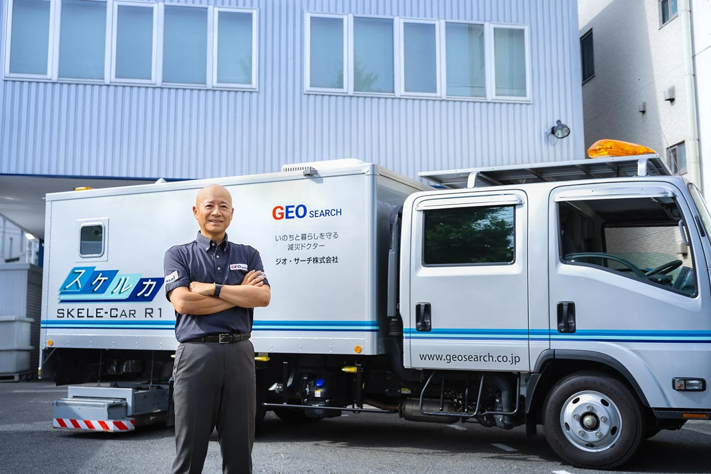
A technology from Japan uses microwave radar and AI to non-destructively and accurately visualize both subsurface cavities linked to sinkholes and the location of underground utilities. Now it is helping cities worldwide become more disaster resilient.
Seeing Beneath the Surface: Revealing Hidden Risks in Underground Infrastructure
August 14, 2026
Read Aloud
As natural disasters become more severe worldwide, Japan—a country long affected by earthquakes and tsunamis—is developing systems to make its communities more resilient. In recent years, technological advances have given rise to new approaches to gensai or proactive disaster mitigation, aimed at reducing disaster risk and minimizing damage. One such example is Gensai Tech, developed by GEO SEARCH Co., Ltd.
This technology visualizes hidden subsurface risks arising from disasters and aging infrastructure. Urban areas have extensive underground networks including water mains, sewer systems, and power lines, and their deterioration is a growing global challenge. These aging infrastructure systems are vulnerable to earthquakes and flooding, while voids caused by leaking water pipes and other factors can gradually expand, eventually leading to ground subsidence or sinkholes. Preventive action has long been difficult because underground assessment usually requires excavation.
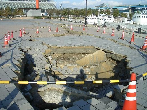
Gensai Tech has the potential to resolve this dilemma. It uses microwave ground penetrating radar (GPR) to create accurate 3D visualizations of underground infrastructure and cavities. “It’s like a doctor who diagnoses a patient and identifies where surgery is needed,” says SAIKA Masatsugu, president of GEO SEARCH.
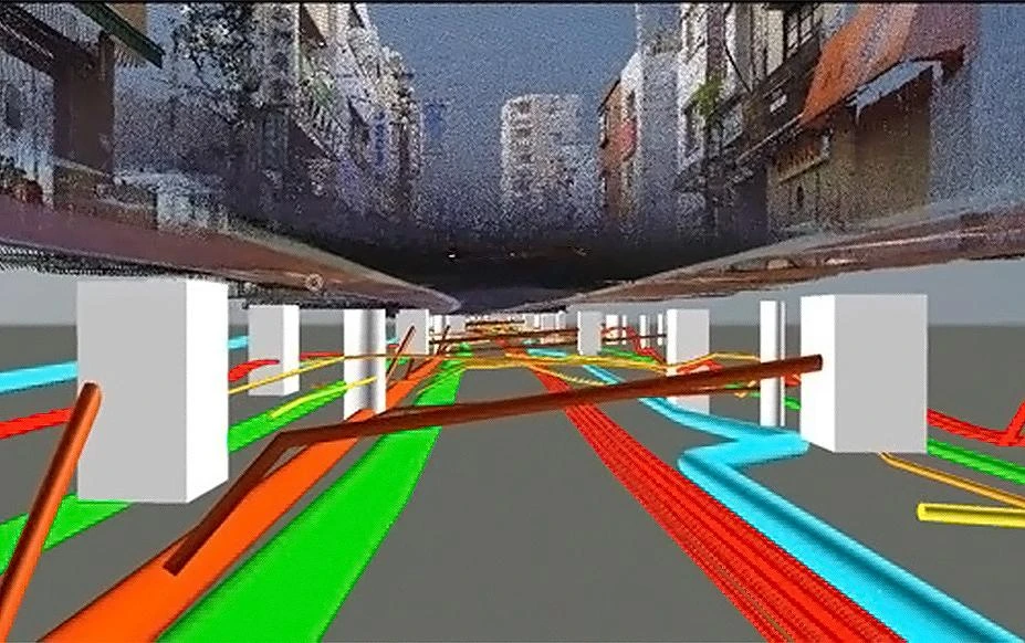
Measuring Underground Conditions Without Excavation
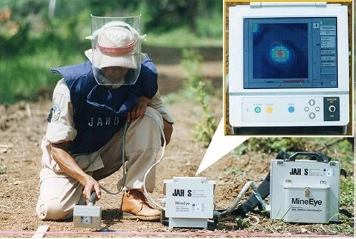
Microwave GPR collects highly accurate 3D data by capturing a large number of cross-sectional scans of underground conditions. Beyond infrastructure surveys, the technology has also been applied to landmine detection. The Gensai Vehicle is a dedicated survey vehicle equipped with microwave GPR. While moving at normal road speeds, it measures underground conditions in a single pass, allowing large areas to be surveyed quickly with minimal disruption to traffic. It is like a highly efficient CT scanner on the move, capable of scanning numerous patients at once. The company has conducted surveys of over 330,000 km of roadway (comparable to circling the Earth about eight times) and has identified more than 170,000 voids.
Its speed makes it valuable for the investigation of underground cavities following disasters. When earthquakes or heavy rains occur, soil can shift or be washed away underground, creating numerous new voids. The area must therefore be surveyed before reconstruction can begin. The company has established 13 bases across Japan, enabling rapid response nationwide within 12 hours of a disaster. The company responds to more than 300 emergency deployments each year (as of 2024), including following the 2011 Great East Japan Earthquake and the 2024 Noto Peninsula Earthquake.
Proprietary Data Analysis Powered by AI and Engineers
In addition to speed, the company also has a strong track record of accurate assessments, underpinned by its proprietary data analysis capabilities. Trained on vast amounts of past data and accumulated expertise, its AI system performs an initial screening. The results are then reviewed through several stages of analysis by different specialist engineers, progressively narrowing down potential voids. Drawing on technical expertise and practical experience, engineers at each stage interpret the data from multiple perspectives, achieving a level of accuracy beyond AI alone.
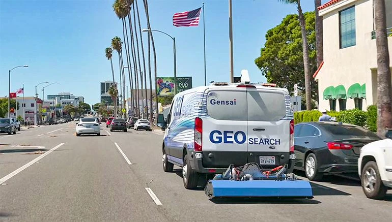
As natural disasters increase worldwide, GEO SEARCH is expanding overseas. The company continues to contribute to surveys of subsurface cavities in Taiwan and has also worked in South Korea. In 2022, it expanded into the United States, where it is conducting demonstration trials. “Our work is much like healthcare, where regular ‘health checkups’ are extremely important. By regularly detecting problems early, identifying treatment areas, and addressing them properly, we can make cities more resilient to disasters,” says Saika. “Aging infrastructure is a challenge shared by cities around the world. We want to lead the way in bringing gensai technologies developed in Japan to the world.”