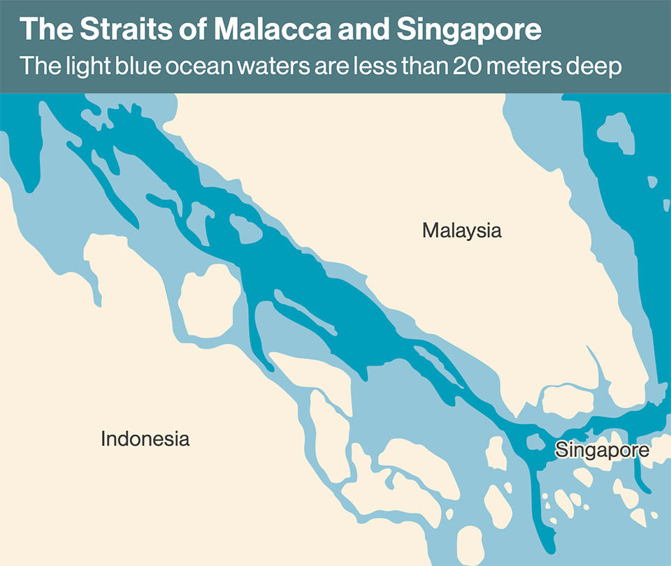
The Straits of Malacca and Singapore are a vital shipping lane linking Asia with Europe and the Middle East. The narrow straits with their predominantly shallow waters constitute a treacherous choke point for passing vessels. Japan has been cooperating with the three littoral States of Indonesia, Malaysia, and Singapore since the 1960s to enhance the safety of navigation, including conducting joint hydrographic surveys.

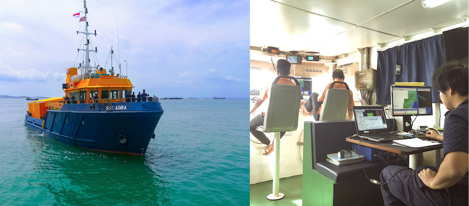
The survey vessel traveled a total distance of 25,000 km. Some of the work was dangerous, as the vessels had to go back and forth along a one-way traffic separation zone. However, with the cooperation of the littoral States, the work was completed with no accidents.
The Straits of Malacca and Singapore, most of which are within the territorial waters of Indonesia, Malaysia, and Singapore, comprise one of the world’s most economically important seaways, with 35% of global shipping passing through. With the growing economic development of the countries belonging to ASEAN (Association of Southeast Asian Nations), the volume of traffic passing through the straits has increased year by year, with approximately 130,000 vessels using the route annually.

“Ensuring navigational safety in the Straits of Malacca and Singapore is a key area of maritime cooperation that will benefit the entire ASEAN region. Japan has been working together with the three littoral States since the 1960s and has contributed to the safety of navigation in the straits in a number of areas, including the removal of shipwrecks, hydrographic surveys, and the production of electronic navigational charts,” said NAGAMATSU Kenji, executive director of the Malacca Strait Council (MSC) of Japan.
Japan has worked on the past three joint hydrographic surveys. The second of those—conducted from 1996 to 1998—established a 500-km traffic separation scheme (in which an area of water separates opposing shipping lanes) and produced the first electronic navigational chart. However, the seabed’s topography has gradually changed and the number of larger ships has increased, leading to an increased risk of marine accidents. There is thus a vital need for more accurate electronic navigational charts.
“As seabed surveying touches on some sensitive security issues, the littoral States were hoping for cooperation from Japan, with which they had established a relationship of trust. The territorial waters of the Straits of Malacca and Singapore are also complex, and Japan plays a coordinating role among the three littoral States,” said Nagamatsu.

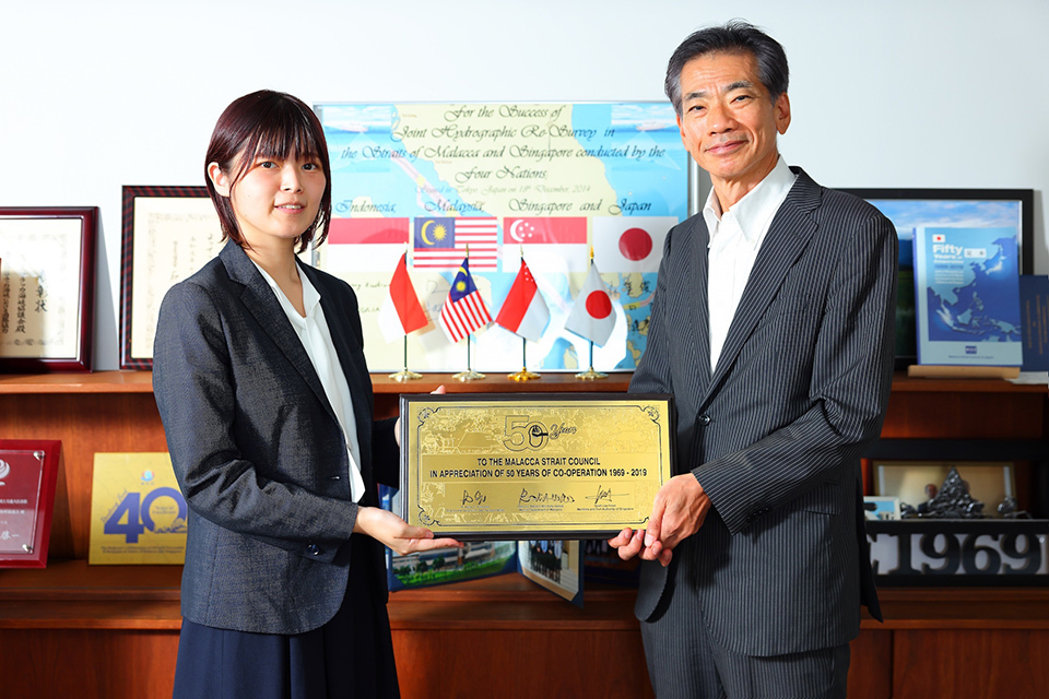
OSHIMA Aoi (left), of Aero Asahi, with NAGAMATSU Kenji, executive director of the Malacca Strait Council. The shield they are holding was sent by the littoral States as a token of their appreciation for Japan’s cooperation over the years.
In response to a request for the third joint hydrographic survey, the littoral States and Japan targeted five specific areas within the Straits of Malacca and Singapore that required particularly urgent action. In Phase I of the survey, which ran from 2015 to 2016, financial cooperation and the dispatch of engineers were provided through the Japanese Shipowners’ Association, the Japan Hydrographic Association, and the MSC. In Phase II, which began conducting its survey in 2018 and covered a larger sea area, approximately 1 billion yen was budgeted by the Japan-ASEAN Integration Fund, established to support integration among ASEAN nations. The MSC oversaw coordination and managed the progress while the private firm Aero Asahi Corporation conducted the survey.
“As such a long country geographically, Japan has established its strength in surveying in diverse environments,” said OSHIMA Aoi of Aero Asahi who coordinated the joint survey. The technology used in the most recent survey was multi-beam sensors that can capture the 3D imagery of the whole section of ocean bed selected for the survey. Oshima continued, “For greater efficiency, the survey ship needs to travel back and forth across the traffic separation zone, but that is as dangerous as driving the wrong way down a busy road. Fortunately, we were able to conduct the survey safely without any accidents, thanks to the littoral States properly communicating information to vessels in the shipping lanes.”
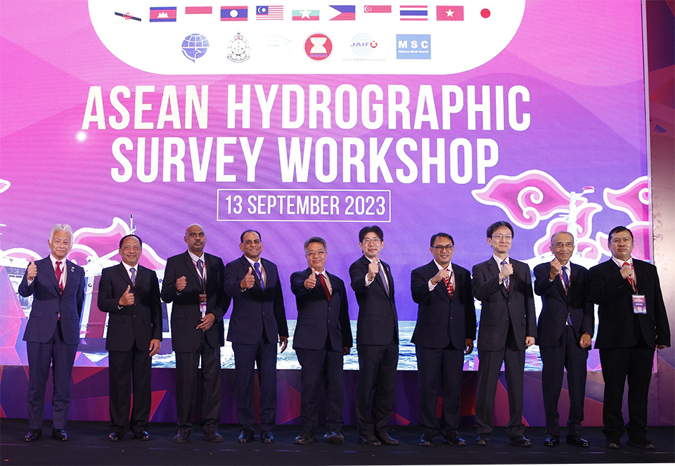
The most difficult part of the survey was the disruption to the project due to COVID-19 restrictions. However, those involved rallied together to collect information and complete the extension procedures, and the survey resumed after a hiatus of two years and four months. With the survey of the whole area completed, the electronic chart was finally updated in July 2023. “The ASEAN Hydrographic Survey Workshop, held in Jakarta in September, was attended by maritime officials from ASEAN member states and received high praise,” noted Nagamatsu.
Not only will the completion of highly accurate electronic charts promote maritime cooperation among ASEAN member states, but it will also greatly improve connectivity. Japan will continue its efforts to collaborate with relevant authorities in order to improve the safety of maritime navigation.

With Japan’s support, and following updates to the electronic navigational chart of the Straits of Malacca and Singapore, the ASEAN Hydrographic Survey Workshop was held in Indonesia in September, at which the results of the project were reported.


