As people in developing nations increasingly flock to live in urban areas, the informal settlements in those cities have also expanded, resulting in a proliferation of the number of residents who live not only in poverty but also alongside the perils of natural disasters and infectious disease. A Japanese university startup is endeavoring to change that reality through the utilization of innovative, AI-based location-analysis technology.
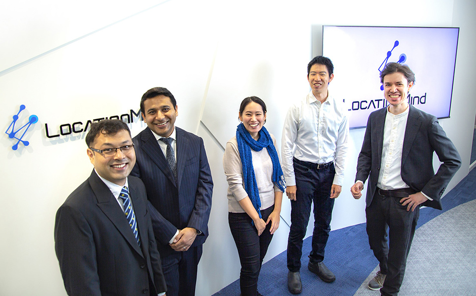
Members of the LocationMind team who are developing the PIVE (Poverty Impact and Vulnerability Evaluation) tool in the Philippines, including SHIBASAKI Mariko (center) and MIYAZAWA Satoshi (second from the right).
In recent years, the world’s population has become increasingly concentrated in urban areas, as they are the main centers of economic activity. United Nations (UN) statistics indicate that these areas occupy approximately only 3% of the total land area globally yet produce more than 80% of the world’s total GDP. Meanwhile, more and more city dwellers in Asia and Africa are living in poor conditions, with insufficient access to public services and education linked to the cycle of poverty. It is difficult to assess where and how these people live when their number increases in a chaotic fashion, and that in turn constitutes a great barrier to the adoption of measures by governments and NPOs for improving their welfare.
A Japanese startup, LocationMind Inc., has taken an innovative approach to solving that problem by utilizing cutting-edge technologies to analyze and predict human movement, or “people flow.” “People flow data” are created by collecting and analyzing location data from smartphones and other devices and visualizing them in an easy-to-understand form. Such data are useful not only for businesses, but also for the tackling of a wide range of social problems, from traffic congestion to disaster control.
LocationMind was established in 2019 by researchers of a laboratory team headed by Professor SHIBASAKI Ryosuke, a renowned authority in this field, who was at the time a professor at the Center for Spatial Information Sciences of the University of Tokyo. Among other initiatives, the company is presently undertaking a joint research project in the metropolitan area of Manila, the capital of the Philippines, together with the Asian Development Bank, to develop what they call the “PIVE (Poverty Impact and Vulnerability Evaluation) tool.” This tool analyzes GPS data, satellite images, census data, and other data by using proprietary AI technology to capture and visualize the state of people living in poverty—which had heretofore not been so well understood. The subjects range from these people’s general living conditions to their access to healthcare and education, as well as the disaster risks to which they are exposed.
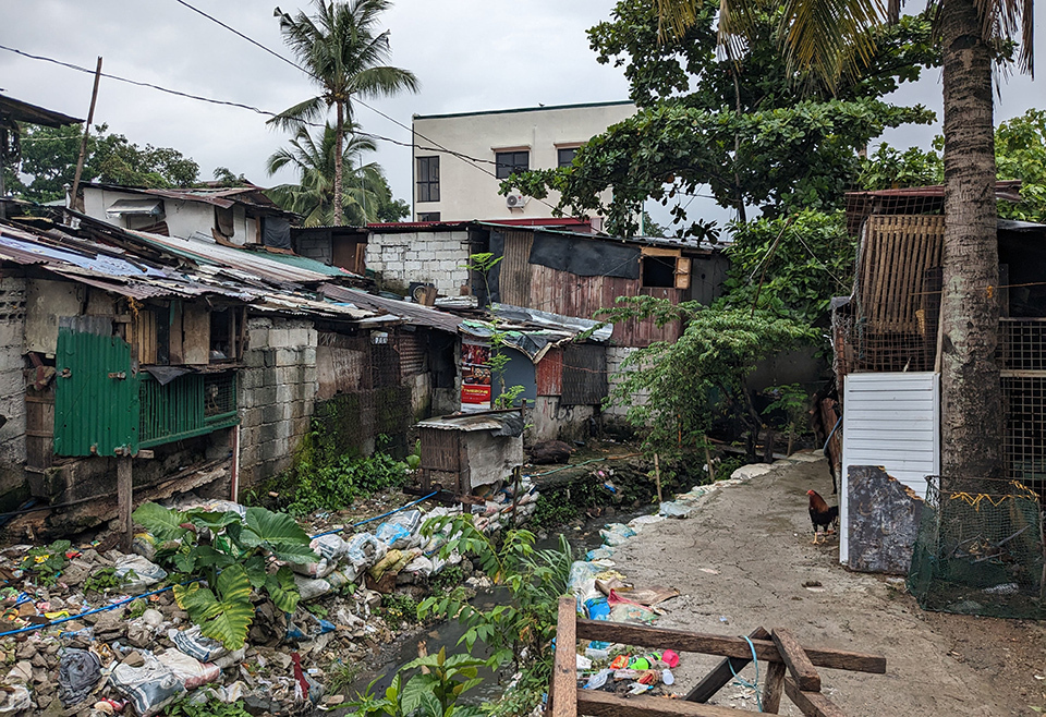
An impoverished settlement in Metro Manila that was selected as the test site for the PIVE tool project. People-flow analysis not only assesses the distribution and concentration of people in such areas, but also helps to better understand their movement in times of disaster, their access to education, and other aspects of how they live.
Since Metro Manila was developed on low-lying plains along several river estuaries, it frequently suffers water damage owing to typhoons and other disasters. The analysis of data from past flood damage and subsequent changes in the flow of people has made it possible to pinpoint high-risk areas and predict the movement of people and traffic when disasters strike. “By providing this information speedily and in an easily accessible form, we aim to support policymakers and NPOs in their decision-making,” said SHIBASAKI Mariko, a consultant working on the development of PIVE.
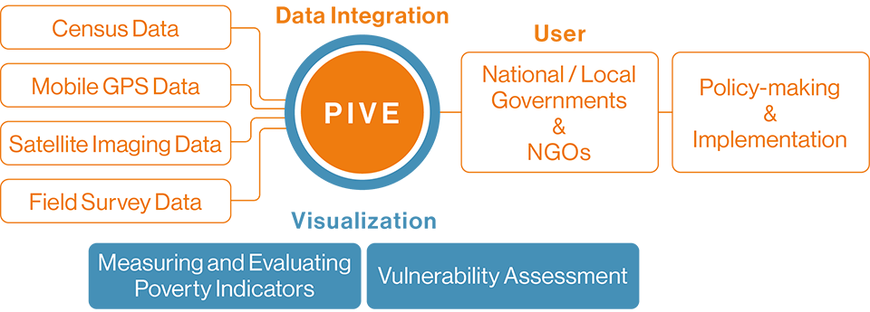
Flowchart of the PIVE Process
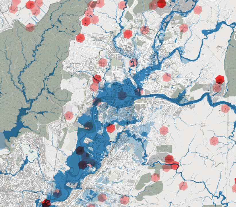
Left: A PIVE map of an area adjacent to Metro Manila that visualizes how people living in poverty tend to settle in places vulnerable to flooding and other disasters. The darker the red, the greater the area occupied by new buildings, including illegal settlements. OPENSTREETMAP CONTRIBUTORS | UP NOAH | PLANET LABS PBC, NORWAY’S INTERNATIONAL CLIMATE AND FORESTS INITIATIVE SATELLITE DATA PROGRAM
A PIVE map of an area adjacent to Metro Manila that visualizes how people living in poverty tend to settle in places vulnerable to flooding and other disasters. The darker the red, the greater the area occupied by new buildings, including illegal settlements. OPENSTREETMAP CONTRIBUTORS | UP NOAH | PLANET LABS PBC, NORWAY’S INTERNATIONAL CLIMATE AND FORESTS INITIATIVE SATELLITE DATA PROGRAM
How to combine and analyze diverse types of data can be a trial-and-error affair, but the company has built up substantial experience in addressing manifold social problems. During the COVID-19 pandemic, for example, the firm contributed greatly to governmental decision-making in Japan through high-quality analyses that predicted infection risks by examining the flow of people in the unprecedented situations that arose—such as the nationwide restriction on unnecessary movement—which is significantly different from that in normal times.
Another instance of such analyses can be found in Indonesia, where a project has been organized to develop a model visualizing residents’ locations and their transportation needs at various times of the day for the purpose of improving public transport in the Jakarta metropolitan area. The project has succeeded in achieving a highly precise system of analysis and prediction—more economically and quickly than conventional means—by applying a distinctive method of utilizing already available GPS data and previous traffic surveys. “Even in situations in which others might give up, experience has convinced us that there must be a solution, so we continue setting up alternate hypotheses and moving on to the next analysis,” explained MIYAZAWA Satoshi, who developed the model, and also serves as a member of the PIVE development team.
The team is currently working on a PIVE prototype that will be further refined by input from policymakers and others. “We aim to eventually build a commercial product that can be used in other nations,” Shibasaki said. The UN predicts that the world’s cities will continue to balloon in population, increasing by an additional 2.5 billion people by the year 2050. If that is to be our future, then PIVE will contribute greatly to realizing the promise of the SDGs (Sustainable Development Goals) agenda, which is to “Leave No One Behind.”
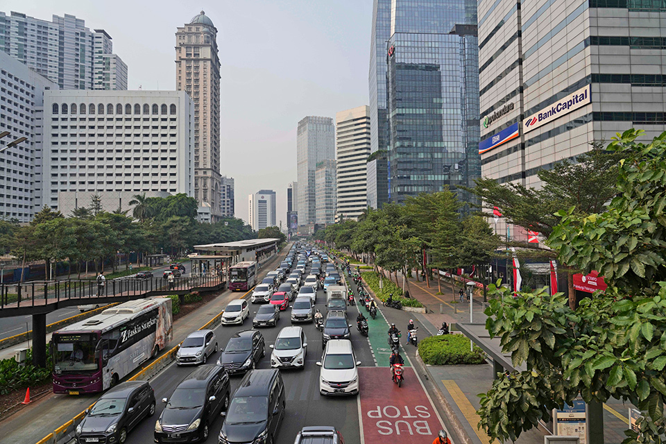
In such fast-growing cities as Indonesia’s capital of Jakarta (photo), public transport plays a key role in relieving traffic congestion and rectifying transport inequalities. In order to establish an efficient public transport system, it is important to assess residents’ locations and their transportation needs at various times of the day. While supporting the development of railways in ASEAN countries, Japan has also cooperated in research and analysis to promote development in line with potential needs. AP/AFLO


